This article was published in Scientific American’s former blog network and reflects the views of the author, not necessarily those of Scientific American
Many of you probably hadn't even been born when Mount St. Helens erupted on May 18th, 1980. You've never lived in an America that basically didn't expect exciting eruptions to happen in the lower 48. So it may be hard to imagine a time when most Americans were utterly astonished that one of our backyard volcanoes roared to life and caused a staggering amount of destruction, along with a substantial number of deaths, within an easy drive of major metropolitan centers.
-
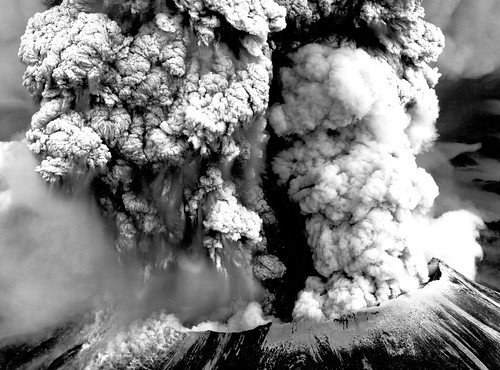
Mount St. Helens in eruption on May 18th, 1980. Credit: USGS
On supporting science journalism
If you're enjoying this article, consider supporting our award-winning journalism by subscribing. By purchasing a subscription you are helping to ensure the future of impactful stories about the discoveries and ideas shaping our world today.
This turned into one of the most well-studied eruptions in human history: American volcanologists had eyes on the mountain from the beginning, and were quick to get instruments to her slopes the instant she woke up. We were able to see the process of an eruption from the initial stirrings of magma deep within the ground, to the paroxysmal blast and its aftermath.
When the precursors were over and the volcano blew its summit on that sunny May morning, things were pretty much complete chaos. Nobody knew quite what was happening. Landmarks had been wiped out or drastically changed. It seemed to many observers that Spirit Lake was completely obliterated; the whole valley appeared to be exploding. It took a while for geologists to sort things out and figure out what happened, where, and why; what remained and what was gone; and what all those explosions in the river valley were all about.
-
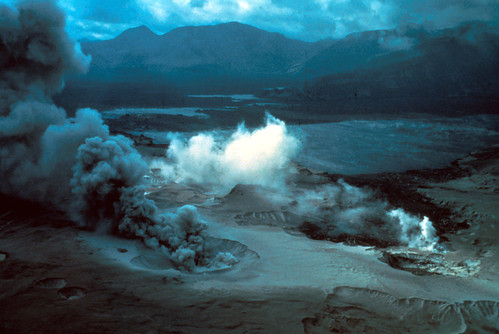
Steam blasts pits in the debris and blast deposits in this view over Spirit Lake. Credit: USGS
When you look at this picture of steaming craters where Spirit Lake used to be, you can see why everybody was flummoxed. Turns out, though, that the explanation was fairly simple: when the summit fell, it brought down glaciers and chunks of that extremely hot cryptodome with it. The magma of the cryptodome was actually hot enough to turn the glacial ice, along with water from the rivers and lakes it buried, into steam, which then blew out craters in the deposits.
-
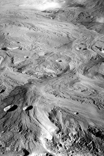
This moonscape is the result of pyroclastic flow deposits pocked with phreatic explosion craters. Credit: USGS
What remained looked lifeless, and in places, eerily like the moon. Geologists starting their initial post-eruption studies and the folks doing search and rescue were astounded by the change. It hardly seemed like the kind of devastation one average-sized volcano could deal.
-
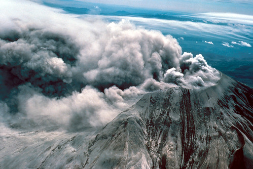
Mount St. Helens on the morning of May 19th. She's been completely changed. Credit: USGS
We'd never seen a volcano change her shape quite so dramatically. We'd never seen a lateral blast of this scope in the continental United States. We'd never had to cope with mudflows pouring off a volcano's slopes, flooding towns and clogging up a major shipping channel. We'd seen plenty of eruptions in places like Alaska and Hawaii. We'd studied volcanoes worldwide. But Mount St. Helens was special. She was home-grown, she was easy to access even after she destroyed bridges and roads, and she's stayed active for decades, teaching generations of volcanologists what to expect before, during, and after a major eruption. We've never been able to study a volcano quite this conveniently before.
On this day, remember the geologists like David Johnston who gave their lives so that we could better understand these beautiful but dangerous fire mountains. Take a look through the archives here and read up on the prelude to the catastrophe, the cataclysm, and some of the immediate aftermath. Go through the series of photos from the 1980s we've collected. And if you haven't had a chance to see our very special volcano live, try to plan a trip to the Pacific Northwest to visit before she changes again.
-
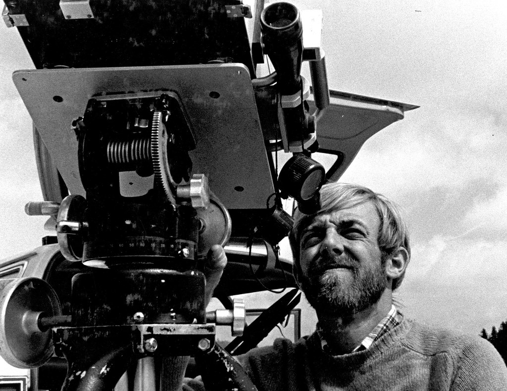
David Johnston. posing with a gas detection instrument a month before his death. Credit: USGS