This article was published in Scientific American’s former blog network and reflects the views of the author, not necessarily those of Scientific American
Along with immigration bans and Mexican border walls, oil pipelines have come up frequently in the news lately. The Dakota Access pipeline (DAPL) has sparked protests among the Standing Rock Sioux community, who fear the completion of the pipeline could harm both their drinking water supply and their sacred burial grounds. Meanwhile, the Keystone XL pipeline has long troubled environmentalists, who argue that such oil-friendly projects should be rejected in favor of clean energy technologies. Both pipelines had previously been stalled by President Obama, but the new administration recently vowed to revive their development.
In the wake of this announcement, fresh anxiety at Standing Rock highlights questions about the risks involved in such a project. Foremost among the hazards of any pipeline, of course, are spills. While supporters of DAPL argue that leaks are rare, the potential damage of even a small spill might outweigh its relative unlikelihood. Back in December, reporters at Undark published a thoughtful and revealing breakdown of this topic, including an interactive visualization of all 1,300 spills that have occurred throughout the U.S. since 2010.
On supporting science journalism
If you're enjoying this article, consider supporting our award-winning journalism by subscribing. By purchasing a subscription you are helping to ensure the future of impactful stories about the discoveries and ideas shaping our world today.
Credit: Undark
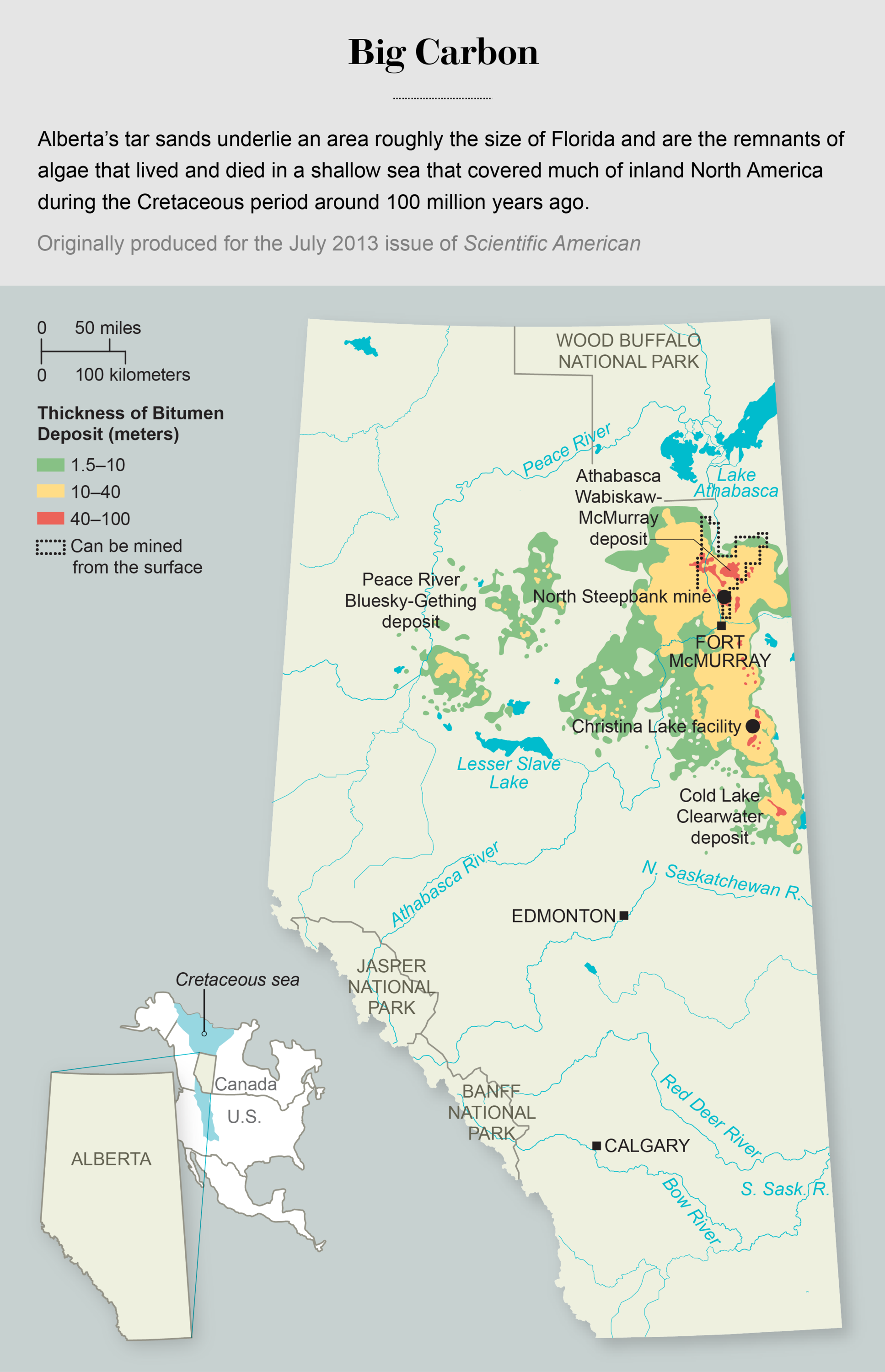
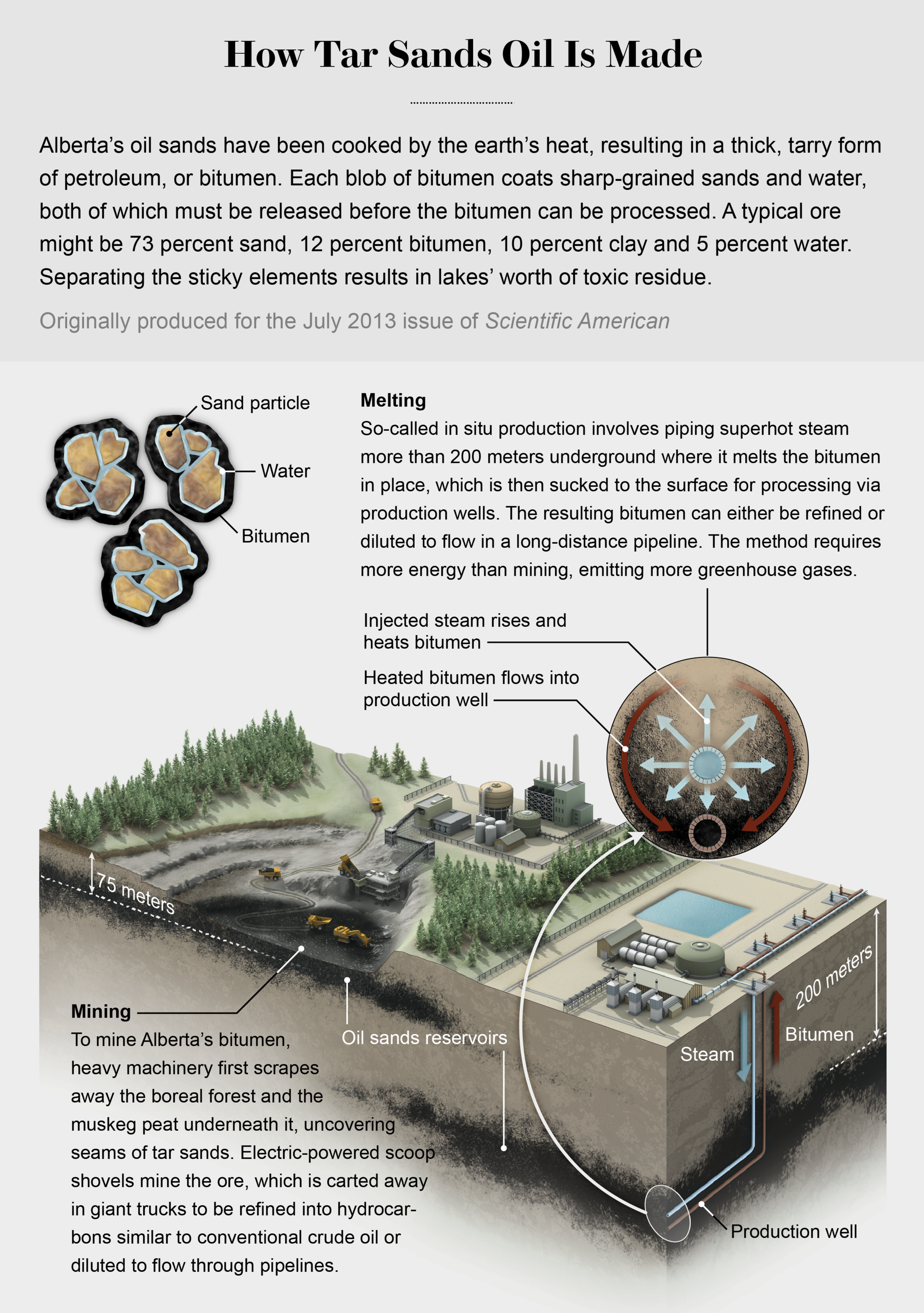
In a lesser known parallel to the Standing Rock resistance, the Keystone XL project has also encountered strong opposition from indigenous communities. The origin of the pipeline is located in Alberta, Canada, where lands long inhabited by several First Nations tribes have been compromised in order to expand the so-called tar sands, a type of mine rich in tarlike oil known as bitumen.
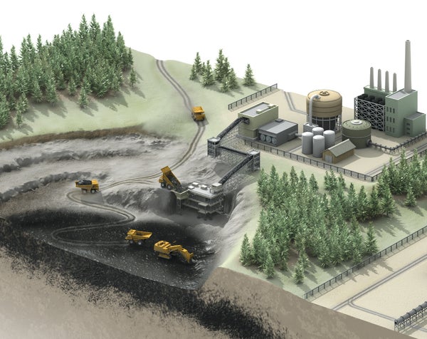
The graphics below, from a July 2013 article in Scientific American, show where the tar sands are located and how they are mined for oil, at significant cost to the environment. (It’s worth noting that, while tar sands expansion and mining are already ongoing, they could be stalled if Keystone XL ultimately fails.)
Credit: Michael Newhouse
Source: Alberta Geological Survey and Energy Resources Conservation Board
If the Dakota Access and Keystone pipelines do proceed, the extent of their impact, both locally and globally, will become clear over time. But while their completion looms, it is important for both public officials and private citizens to be as informed as possible about the potential costs, both environmental and social, of these ambitious projects.