This article was published in Scientific American’s former blog network and reflects the views of the author, not necessarily those of Scientific American
Here are yet more delights I found for you whilst spelunking the USGS photo database. The May 18th and its aftermath presented us with some really spectacular photo opportunities, and we've a long way to go before we've enjoyed them all.
This is one of the more cheerful of the early maps drawn depicting the damage wot Mount St. Helens wrought.
-
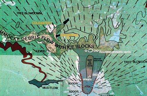
Map of features and deposits of Mount St. Helens. Map by J. Moore. Image and Caption Credit: USGS
On supporting science journalism
If you're enjoying this article, consider supporting our award-winning journalism by subscribing. By purchasing a subscription you are helping to ensure the future of impactful stories about the discoveries and ideas shaping our world today.
Mount St. Helens in eruption on May 18th. I'm quite fascinated by how straight a slice was taken off the top of the volcano. Aside from the notch in the north, it's almost like someone took a machete and lopped off the summit. I hope that somewhere in the remainder of Professional Paper 1251, someone explains why.
-
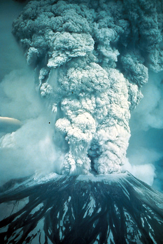
Oblique aerial view of the eruption of May 18, 1980, which sent volcanic ash, steam, water, and debris to a height of 60,000 feet. The mountain lost 1300 feet of altitude and about 2/3-cubic mile of material. Note the material streaming downward from the center of the plume and the formation and movement of pyroclastic flows down the left flank of the volcano. Photo by Austin Post. Skamania County, Washington. May 18, 1980. Image and Caption Credit: USGS
Here's a rather nice view of Mount St. Helens's truncated top, showing where all the glaciers are. The poor buggers were basically beheaded when the mountain blew.
-
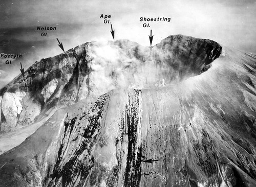
Aerial view of crater rim following the May 18 eruption. Arrows above the far rim indicate exposed cross sections (left to right) of Forsyth, Nelson, Ape, and Shoestring Glaciers. The horizontal arrow on the near slope indicates typical rills and channels through ash deposits into Talus Glacier (note crevasse further down the glacier). Dark (wet) streaks to the left indicate the ash covered Toutle Glacier. Photo 8059-115 by Austin Post. Skamania County, Washington. July 24, 1980. Figure 7 in U.S. Geological Survey. Circular 850-D. 1981. Image and Caption Credit: USGS
Some absolutely luscious erosion in the blast deposits. Check out those enormous trees being unearthed!
-

Some absolutely luscious erosion in the blast deposits. Check out those enormous trees being unearthed! Image and Caption Credit: USGS
You'll all be glad to know that, although I came to the end of the results from my original search term, I just uncovered about a thousand more photos by using a different search term. So you're all gonna be getting images of Mount St. Helens for some time.
-
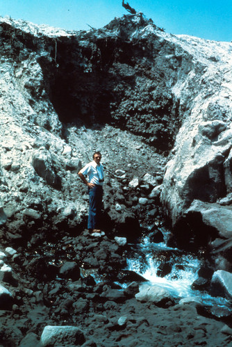
Shortly after the eruption water was flowing through the mudflow and entering the stream at the canyon as a spring. This water is clear and cold. You notice the stratigraphy of the mudflow and debris deposited throughout. Man for scale. Skamania County, Washington. 1980. Image and Caption Credit: USGS
Avalanche lilies growing in a channel eroded into volcanic deposits. It's amazing how those delicate little things thrived in so much destruction.
-
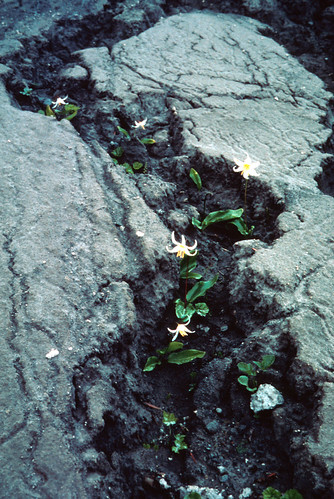
Avalanche lilies in bloom above St. Helens Lake, north of Mount St. Helens. Skamania County, Washington. June 20, 1980. Image and Caption Credit: USGS