This article was published in Scientific American’s former blog network and reflects the views of the author, not necessarily those of Scientific American
At long last, I have finished going through the entire USGS database of photos tagged Mount St. Helens. There were so many treasures! I'll be bringing them to you for some time.
This is a fabulous, almost sci-fi view of a bit of pumice under a scanning electron microscope. Those textures are just exquisite! You'll notice it's more air than substance, which is why pumice tends to float.
On supporting science journalism
If you're enjoying this article, consider supporting our award-winning journalism by subscribing. By purchasing a subscription you are helping to ensure the future of impactful stories about the discoveries and ideas shaping our world today.
-
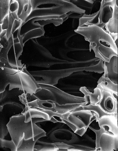
"Scanning electron microscope (SEM) images of pumiceous material from the May 18, 1980 eruption of Mount St. Helens. Interior of pumice clast collected in Yakima on May 18. Photo by D.R. Pevear. Yakima County, Washington. May 18, 1980. Figure 385-A, U.S. Geological Survey. Professional paper 1250." Credit: USGS
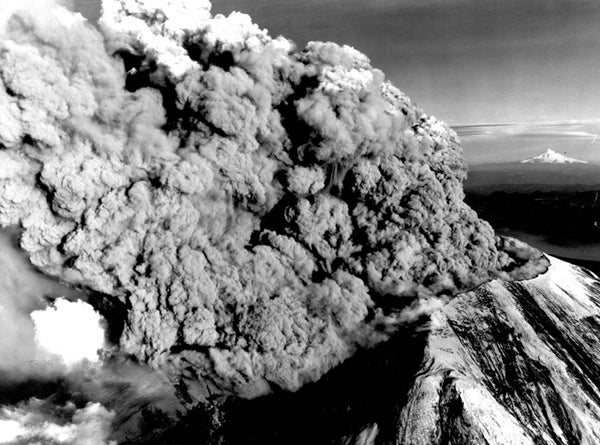
Even after the enormous May 18th eruption, Mount St. Helens had a lot of exploding left to do before she could settle down. This magnificent photo of her July 22 1980 eruption shows her hurling a thick column of ash at the sky, while a pyroclastic flow roars out through the gap in her northern crater wall.
-
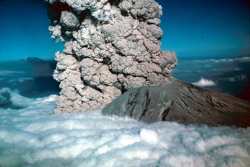
"These slides of the July 22, 1980 eruption of Mount St. Hellens were taken by Jim Vallance, who was in a U.S. Forest Service fixed wing aircraft and by Mike Doukas, Harry Glicken, and Rick Hoblitt who were in a U.S. Geological Survey helicopter. There were three major eruptive pulses on July 22, 1980. They begin at 17:14, 18:30 and 19:02 PDT. Slides no. 5 through 25 were taken between 18:25:20 and 18:26:30 This sequence was taken while moving counter-clockwise from the north to the west flank of Mount St. Helens at a distance of about 7 miles and while changing elevation from about 10,000 to 12,000 feet. Approximately 3 seconds after slide no. 20. Skamania County, Washington. (Photo by J. Vallance-U.S. Forrest Service). View of eruption at 18:27. Base of vertical column and elutriate cloud from pyroclastic flow rising through cloud layer. Mount Adams in background. Skamania County, Washington." Credit: USGS
The July 22nd 1980 eruption was quite thoroughly photographed. I'm hoping to put together a gif of some sort once I've located all the slides and put then in chronological order, but in the meantime, here's this really striking shot of the third eruptive pulse. She still had a lot left in her.
-
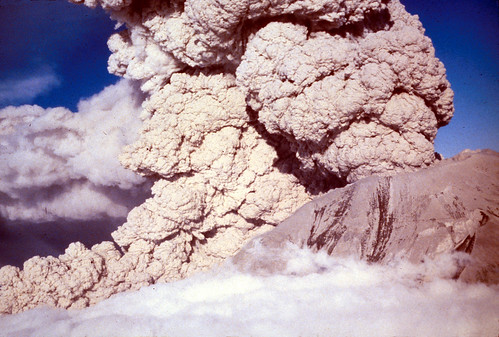
"These slides of the July 22, 1980 eruption of Mount St. Hellens were taken by Jim Vallance, who was in a U.S. Forest Service fixed wing aircraft and by Mike Doukas, Harry Glicken, and Rick Hoblitt who were in a U.S. Geological Survey helicopter. There were three major eruptive pulses on July 22, 1980. They begin at 17:14, 18:30 and 19:02 PDT. 19:05 third eruptive pulse, view from west. Skamania County, Washington. (Photo by H. Glicken-U.S. Forrest Service)" Credit: USGS
Here are some geologists poking round inside a pit on the pumice plain. This is a few years after the May 1980 eruption, so erosion has got well underway, but you can see how raw the landscape is still. And that is one huge pit. The caption doesn't say, but I believe it was caused by one of the steam explosions.
-
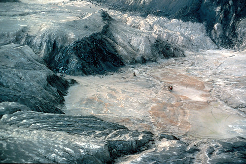
"Scientists in pit on pumice plain. Note erosion into pit in three years since May 18, 1980, eruption. Skamania County, Washington. October 5, 1983. Photograph by Lyn Topinka." Credit: USGS
This may only be delicious to those of us who are really in to geology, but: erosion in lahar deposits. Yum! It's taken about a year for streams to cut down that far.
Note for creationists: once again, these are unconsolidated deposits. Don't get all excited by the pace of erosion here.
-
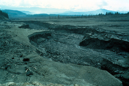
"Channel erosion on mudflow surface, looking downstream from Upper Muddy River about a year after the May 18, 1980, eruption. Compare with photo 26. Skamania County, Washington. October 10, 1981. Photograph by Lyn Topinka." Credit: USGS
Here's a view across the North Fork Toutle River valley, looking into the maw of Mount St. Helens. The valley is filled with debris avalanche and blast deposits. Note the huge trees stripped of all their limbs and stuck into the deposits any-old-how.
-
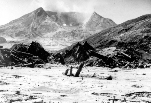
"Devastated area in the valley of the North Toutle River showing deforestation, reordered drainage, and the surface of debris flow and blast deposits resulting from the eruption of Mount St. Helens. View looking south shows volcano no and amphitheater in background. Photo by C. Dan Miller. Skamania County, Washington. 1980. Published as lower photo, p. 15 in U.S. Geological Survey. Yearbook. 1980." Credit: USGS