This article was published in Scientific American’s former blog network and reflects the views of the author, not necessarily those of Scientific American
We almost didn't. Ya'll can thank B for your Baker photos today, because he's the one who said, "Let's do it." See, when we got up Friday morning, the cloud cover was thick and low. Weather.com promised me partly sunny skies at Mount Baker, but I hadn't any faith, especially not with the Cascade foothills covered in clouds. I was ready to give it all up and head to Larrabee State Park instead. But B wanted Baker, and he convinced me to take a chance on it. So up we went.
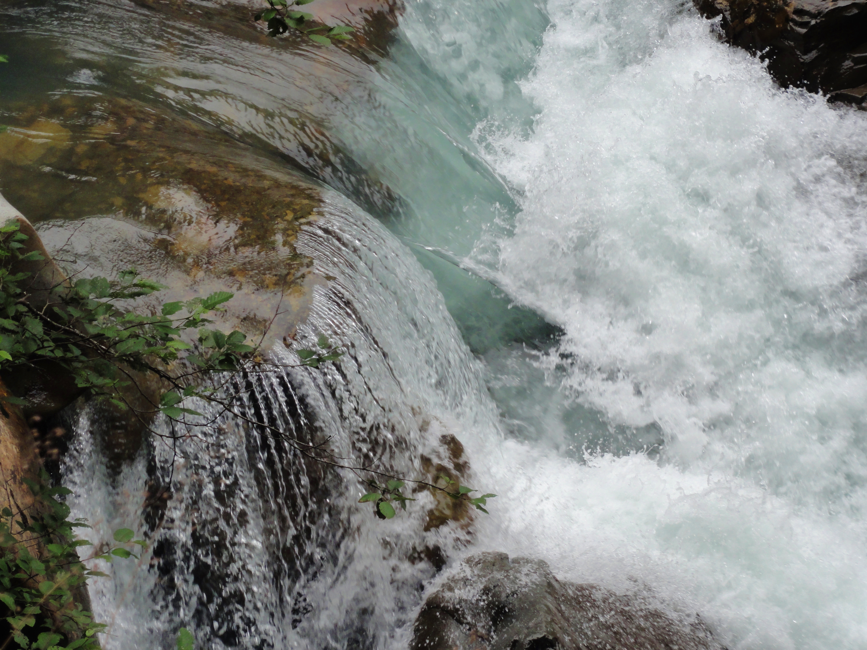
We stopped by Nooksack Falls first, to kind of warm up, and to give the clouds a chance to burn off. We had a magnificent time. We were the only ones there for most of the time, and we got lots of photos of the top of the falls, and of the side creek bringing in a huge load of sediment. Here's one of the prettiest pictures, which was taken when we were walking beside the falls on the way to the car. This is at the top, as the water begins its downward plunge:

On supporting science journalism
If you're enjoying this article, consider supporting our award-winning journalism by subscribing. By purchasing a subscription you are helping to ensure the future of impactful stories about the discoveries and ideas shaping our world today.
That sublime brown rock is 180 million years old, erupted in a Jurassic ocean, according to geologist Ron Tabor. That's some pretty super-awesome stuff, and some of the oldest rock in Western Washington if I remember right.
This seems like a great place to come on a hot day, because it was a warm day and yet we nearly froze. So we didn't linger. We headed up the mountain, and were cheered by a few sunbreaks. Then, by the time we'd reached Heather Meadows, we were in bright sunshine. Sure, there was a bit of haze in the air, and yeah, there were so many clouds to the east that you couldn't see off the slopes, much less out across the valley, but it was a lot better than expected. We stopped at the Visitor's Center, where the ranger on duty told us that Artist's Point was completely clear of snow, and I screamed for joy, because that meant we could do the Table Mountain hike.
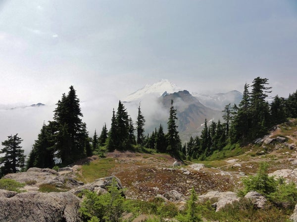
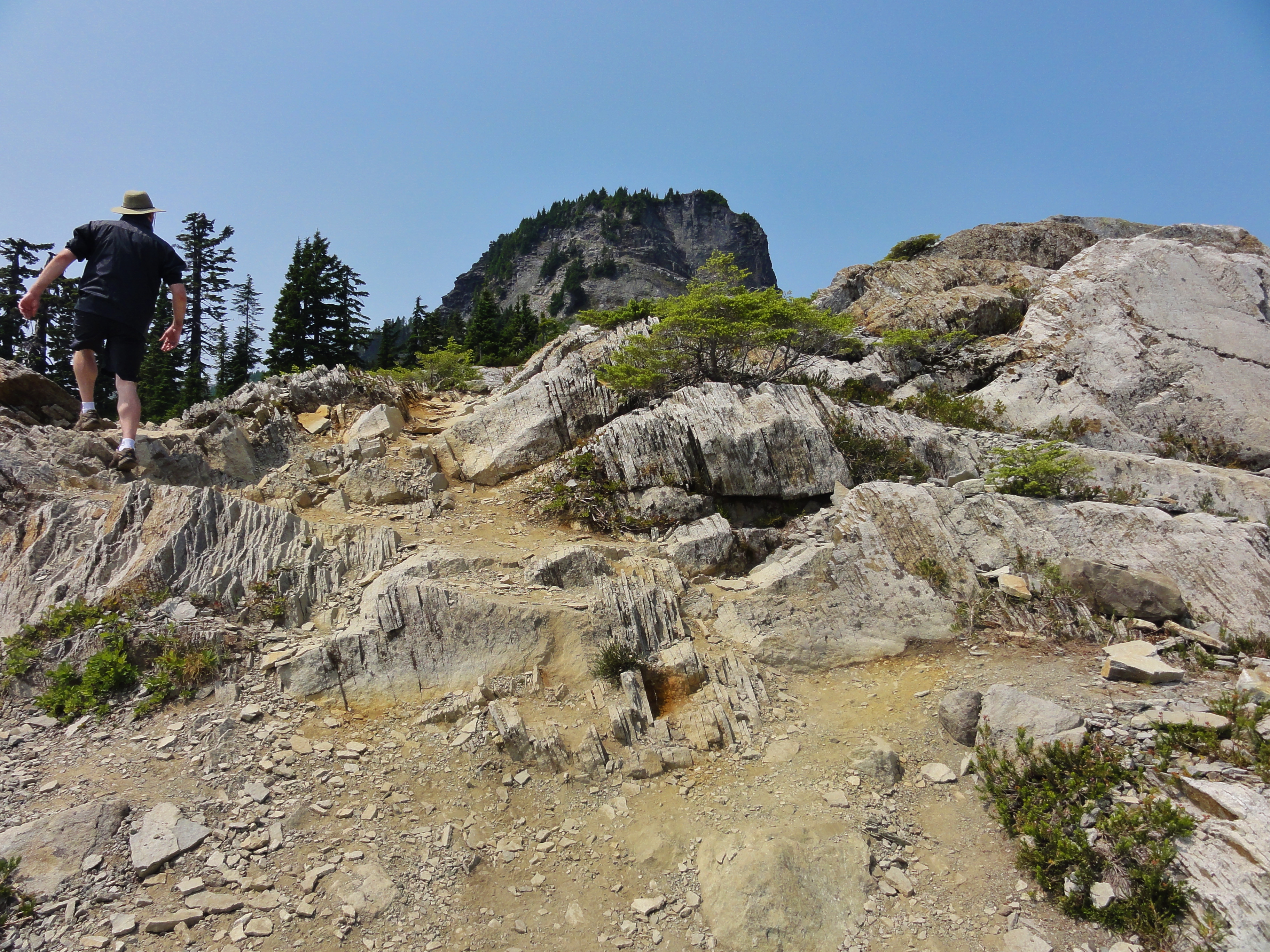
We almost didn't make it, because I slipped on a nearly-invisible rock at the trailhead* and fell like a drunken tree. But I only sustained minor flesh wounds and a few bruises, so after a brief dalliance with the first aid kit, we took off up the trail. The views were spectacular in some directions, iffy in others, and Mount Baker was trying to hide, but we got some great shots for ye. Here's the only glimpse of Baker you're going to get:
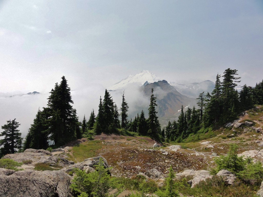
We found some incredible exposures of platy andesite, and got some lovely looks at Table Mountain.

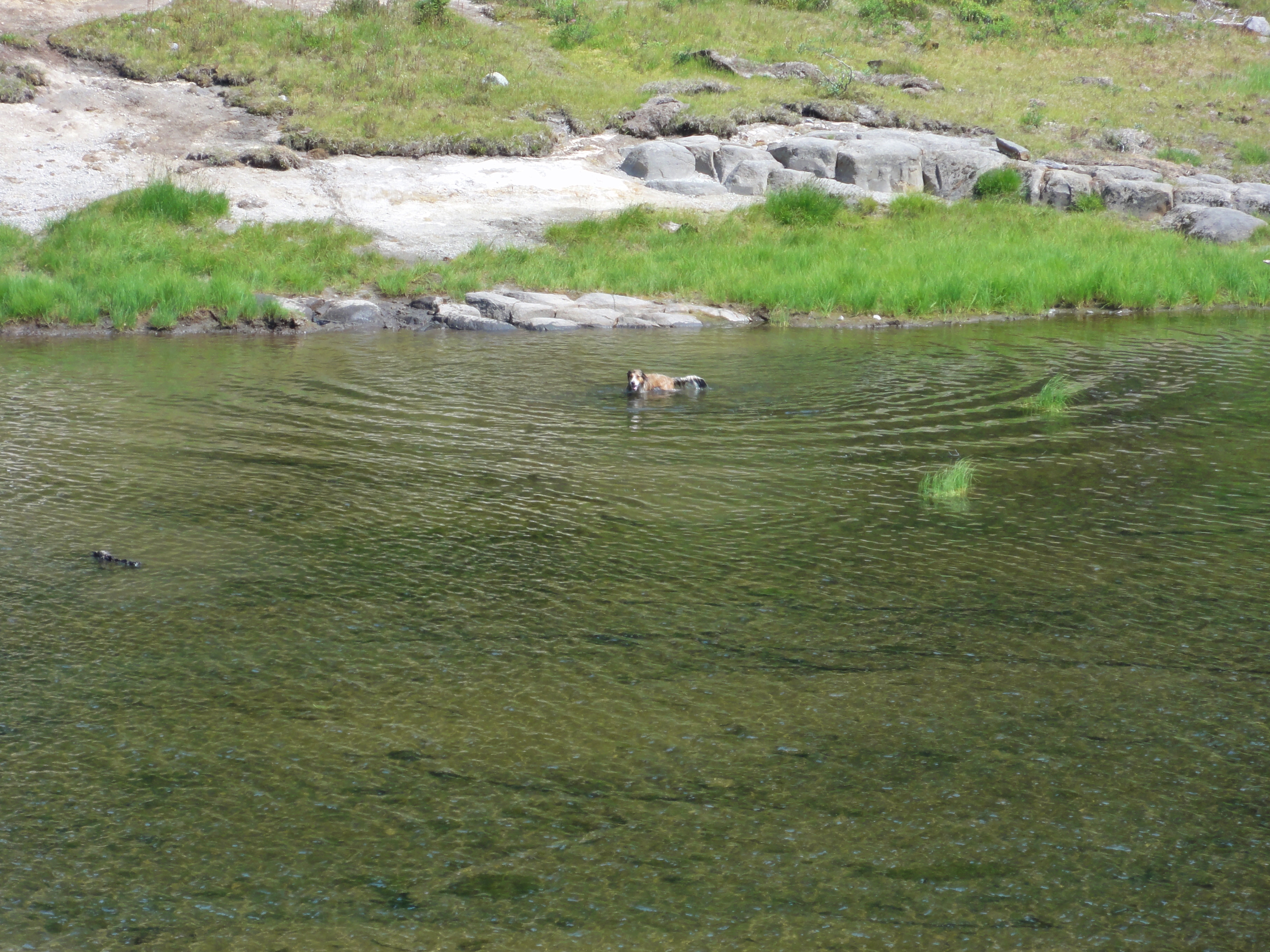
But a hiker coming down said the horseflies were being vicious at the top, and with half of our view completely obscured by thick clouds, we decided to save the very top for another day. We wanted to get back to Heather Meadows and walk round the lakes, which we did. Well, we walked around Bagley Lake, anyway. ZOMG, people, so many butterflies. I will have some magnificent specimens for you. And there was this happy doggy taking a swim in freezing-cold meltwater.

A little further on, we stopped so I could take this photograph for you.
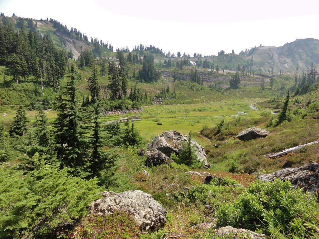
I'll get a better version on a clearer day, but there's a lot going on in this photo, and we can see it despite the haze. In the foreground, those huge boulders are part of a rockslide off of Mount Herman, which seems to be falling to pieces. A ranger we met on the trail told us it's the oldest mountain in the area, so I suppose that's fair. Anyway, there's this sweet rockslide down into the valley, which is a valley carved out of the volcanic and sedimentary rocks by a glacier. If you're standing in this spot and look to the right, you'll see the cirque where the glacier originated. Enlarge the image a bit, and you'll see the stream flowing from the tarn to Bagley Lake proper. Across it is a peninsula of lovely andesite columns. Behind it is the ridge the visitor's center is on, and it's practically all columns as well. It's been planed down smooth in places by the glacier. I believe we're looking at some inverted topography there, but I'd have to do more research on the area to be sure. It's for certain a lava flow.
That's a lot of geology in one quick glance, innit?
We got many more delicious things we shall show you eventually. And it's a good thing we got there when we did, because as we were hiking back to the VC, the clouds were beginning to sweep over the ridge. Look at Table Mountain, all fog-wrapped and mysterious:

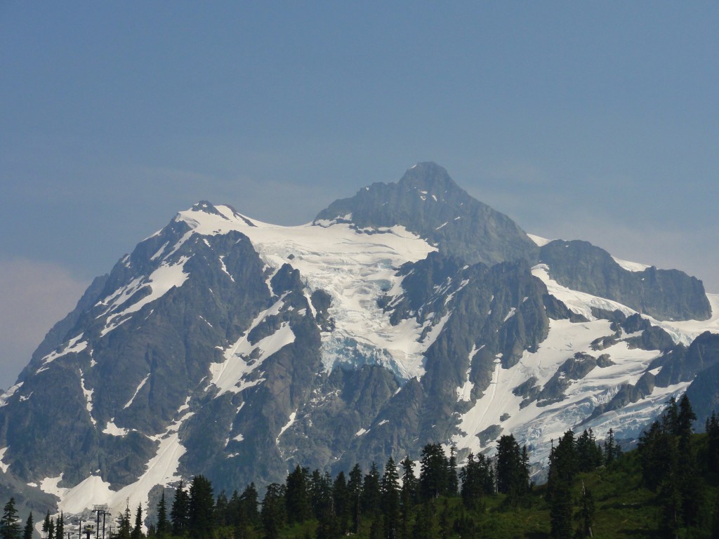
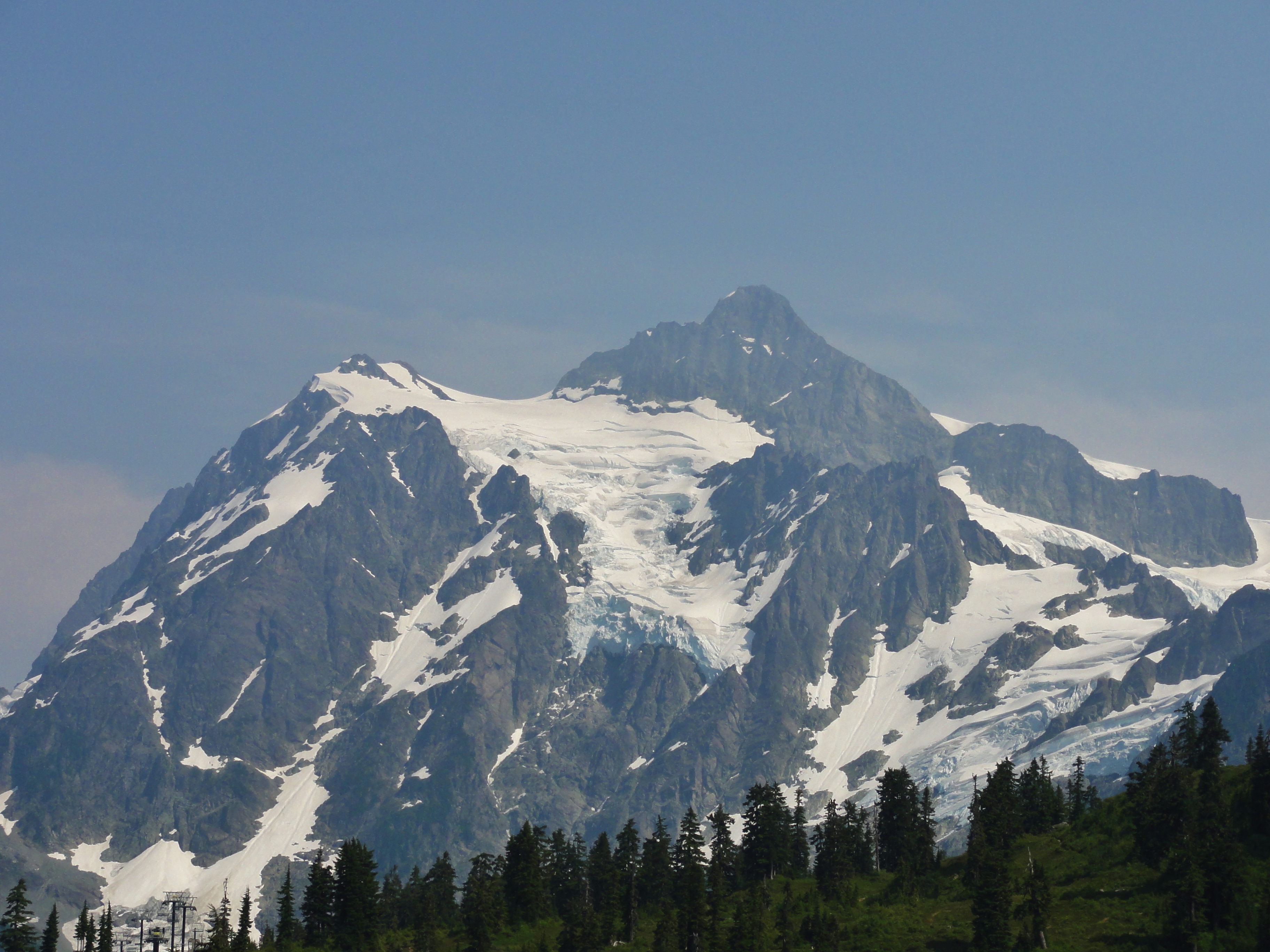
But the clouds hadn't yet reached Mount Shuksan, and we caught some of its cool glacial action on the way back.
Glaciers are so tasty!
I can't wait to get back up there with some more knowledge under my belt, but they're apparently going to be working on Highway 542 all summer, and so B and I are going to concentrate our energies elsewhere. We'll get back up in the late fall, or sometime next summer. In the meantime, we have plans to visit Mount St. Helens next week, as long as the weather doesn't suck, so you can look forward to more of that.
*Watch for that rock when you go. After it tripped me, it nearly got another poor gentleman whilst I was standing there inspecting my scrapes. It blends in with the surrounding light-tan dirt, and it's covered in a powdery coating of said dirt that makes it extra-slippery. Yikes!
Originally published at En Tequila Es Verdad.