This article was published in Scientific American’s former blog network and reflects the views of the author, not necessarily those of Scientific American
I love my old home state of Arizona, but not its politicians. Right now, I despise them.
Arizona is full of some of the richest geology in the world. I mean, the Grand Canyon is only the beginning, okay? I've told you about the Permian Riviera, and the desert karst oasis in the midst of an ancient lake. I haven't even begun to scratch the surface of her mineral wealth. From ancient seas to continental sutures to young volcanoes, Arizona has about everything you'd need to educate yourself in the earth sciences.
Between the tourist dollars, mineral resources, and educational opportunities Arizona's geology offers, you'd think that the AZ Geological Survey would be well-funded. But short-sighted politicians have destroyed its budget and threatened its survival. It's being forced to move into offices a quarter of their current size without a relocation budget, meaning that invaluable samples and documentation could be lost. And it's new home at the University of Arizona hasn't been given funding to run it.
On supporting science journalism
If you're enjoying this article, consider supporting our award-winning journalism by subscribing. By purchasing a subscription you are helping to ensure the future of impactful stories about the discoveries and ideas shaping our world today.
You know what this does? It not only threatens Arizona's natural resources and economic health, it places her citizens at risk.
Because the AZ Geological Survey isn't just there to study and document all of the outstanding geology in the state. One of its core missions is to discover and analyze geohazards. Let's discuss those for a moment, then, shall we?

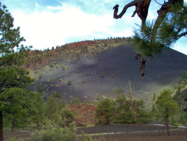
Volcanoes: The San Francisco Volcanic Field's most recent eruption was just under a thousand years ago. That's practically yesterday in geologic terms - and it's not the only young volcanic field in the state. Arizona will very likely experience eruptions in the future. We need to monitor those fields to protect residents and resources.
Landslides: Many areas, especially scenic ones, are at risk of various types of landsliding. These hazards couldn't be identified and mitigated without the AZGS. The studies they do are critical for protecting infrastructure, homes, businesses, and lives.
Earth Fissures: These enormous cracks open due to subsidence accompanying groundwater removal. They're aggravated by Arizona's summer monsoon rains. They're dangerous to property, people, and livestock. The maps the AZGS develops help mitigate the hazard.
Floods: Yeah, Arizona's dry, but what rain we get is often in downpours. The dry soils can't absorb that much water quickly enough to keep it from thundering down the dry washes and slot canyons. Flash floods kill! Damage to infrastructure can be extensive. And when the nearly-dry rivers overflow, houses built on floodplains suffer. People need the AZGS to show them where the potential for flooding is and how to mitigate it.
Debris Flows: Imagine raging floods filled with boulders and debris thundering at you or your home. There's not much holding back the rock and earth in many places, especially in those areas already devastated by the fires the state is so prone to. So when those rains drench the arid land, we end up with huge slurries of rocky mud that can destroy everything we've worked so hard to build. The AZGS identifies areas at high risk so that we can plan appropriately.
Earthquakes: Arizona's not known for 'em, but it's got 'em. The Colorado Plateau gets regularly rocked, and Yuma is actually at risk from the San Andreas and associated fault systems. Arizona also contains part of the Basin and Range: those lovely desert mountains are quite often fault-block mountains created by repeated earthquakes. The AZGS is needed to map fault systems so that we know what to prepare for.
Radon Hot Spots: While Arizona isn't at the top of the list for radon hazards, there are some areas where the poisonous gas puts homeowners at risk. The AZGS identifies those areas so that homeowners can be aware of the danger and take appropriate precautions.
Karst: Remember that desert karst oasis I talked about? It's there because of a sinkhole. Arizona is covered in limestone, and as a consequence is prone to all of the hazards karst landscapes produce. We've discussed here what sinkholes can do to people and property. We need the AZGS to map and monitor karst so that people don't end up losing their homes, business, and possibly lives.
Problem soils: Arizona is full of clay-rich soils that swell with each rain and shrink with each dry spell. I used to travel home from Flagstaff over roads that felt like a roller coaster due to the expansion and contraction of those soils. They're an enormous problem for homes, businesses, infrastructure, and pipelines. And who's there to map out where they are and help deal with them? That's right - the AZGS.
Also, Arsenic: As if all of the above weren't enough to convince you that the AZGS is necessary, there's also the problem of arsenic leeching into our water supplies.
On top of all of the lovely things the AZGS does to help Arizona live with its beautiful but often dangerous geology, there's all the science outreach they do. We need more of that, not less.
So, please, let the governor know that the AZGS must be fully funded. Save this amazing agency. Preserve Arizona's geological wonders and our knowledge of them.
