This article was published in Scientific American’s former blog network and reflects the views of the author, not necessarily those of Scientific American
Those informational signs at various attractions can sometimes be more aptly described as

The offending Summer Lake sign. Credit: Dana Hunter
mis-informational. This tends to frustrate the geotraveler: responses may include groans, gripes, and rolling eyes. One severely-annoyed geologist at Summer Lake, Oregon took matters (and a Sharpie) into their own hands, and engaged in a little correcting-their-fieldwork.
On supporting science journalism
If you're enjoying this article, consider supporting our award-winning journalism by subscribing. By purchasing a subscription you are helping to ensure the future of impactful stories about the discoveries and ideas shaping our world today.
If it's educational, is it still vandalism - or a public service? Asking for a geologist.
One sign that's just begging for the Sharpie treatment is this one at Deception Falls.

Two plausible and one frankly impossible hypotheses. Credit: Dana Hunter
It's displayed at a fascinating part of the Tye River, where it goes from a broadish (if rocky) channel to a rather vigorous falls, and then makes a razor-sharp 90° turn to flow through a narrow, straight grandiorite channel.
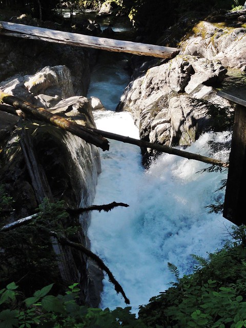
The river turns sharply! Credit: Dana Hunter
Wow, right? That's some dramatic geology, that is. Rivers don't usually do that.
The sign gives three speculations as to how this odd feature formed. Have a look at the video of the falls, and then see if you can spot the laughably ridiculous hypothesis:
1. Log Jam: Did a maclargehuge flood carry a load of logs down and dam the river, diverting it long enough to cut a new channel at a 90° angle to the original?

Log pile left by flood waters at Deception Falls. Credit: Dana Hunter
2. Dike. Did the river erode away a dike of softer rock? The granitic bedrock at Deception Falls is cut by a myriad of dikes in various igneous materials.
Small (possibly andesite) dikes cutting through bedrock. There are several large dikes of basalt and other igneous rock around the area as well. Credit: Dana Hunter
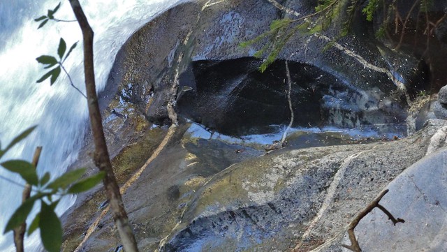
3. Fault. Did the river attack the crushed and broken rock of a fault, finding it easier to remove than unbroken bedrock?

A waterfall on Deception Creek plunges through a probable fault zone. Credit: Dana Hunter
Bonus geoblogosphere points shall be awarded to those who make a case for one or both of the remaining options.
A version of this post previously appeared at En Tequila Es Verdad.