This article was published in Scientific American’s former blog network and reflects the views of the author, not necessarily those of Scientific American
Along the great rivers of the U.S.—the Mississippi, Missouri, Ohio, Illinois and many others—history is tied to the syncopated rhythm of flooding. The great flood years of 1927, 1937, 1993 and 2011 are still remembered and discussed in history classrooms and around the family dinner table in many communities. Similarly, if you drill into most U.S. levees, you find marks similar to the growth rings of a tree, showing that the levee was enlarged multiple times, each time following failure during a previous flood event.
In 2019, with record and near-record flooding on many rivers, we need to look carefully at what agenda the country will set in the wake of this year's floods. In particular, the U.S. needs to scrutinize and resist the temptation to rely single-mindedly on levee protection—the "levees only" engineering strategy that failed the country so catastrophically in the past century.
I myself am a scientist but also a believer in the adage that those who ignore history are doomed to repeat its mistakes. Rewind to the 1849 flood on the Lower Mississippi, which devastated New Orleans, captured national attention and launched two competing Congressionally-funded studies of how our new country should address crippling flooding along the rivers of its western frontier.
On supporting science journalism
If you're enjoying this article, consider supporting our award-winning journalism by subscribing. By purchasing a subscription you are helping to ensure the future of impactful stories about the discoveries and ideas shaping our world today.
Charles Ellet, a renowned civil engineer completed a sweeping assessment of the Mississippi and Ohio Rivers and concluded that the U.S. needed multilayered protection against flooding, including levees, dams and reservoirs, bypass channels and outlets, and wetlands to absorb rainwater. The second study, headed by A. A. Humphreys of the U.S. Army Corps of Engineers, came to the opposite conclusion—that the country's flood-control efforts should be concentrated solely in levees. With the authority of the Corps of Engineers behind him, Humphrey's dogma of "levees only" prevailed for decades:
"Many plans have been suggested for the prevention of floods on the Lower Mississippi—Outlets, Reservoirs, Cut-offs, Diversion of Tributaries, and Levees. All of these plans have been investigated thoroughly by the engineers corps of the Army and all have been discarded as inapplicable with the exception of the levee system, which has been recommended as the proper method." From Floods and levees of the Mississippi River, by B. G. Humphreys. The Mississippi River Levee Association: Washington, D.C., 1914
Through the end of the 19th century and the first decades of the 20th century, the Corps devoted its resources and investment into building and enlarging levees, placing them as close to the river channel as possible, and eschewing alternative approaches. The levees-only dogma even included closing off natural river chutes and outlets in the belief that flow confinement by levees could "train" these great rivers to safely convey even the largest floods.
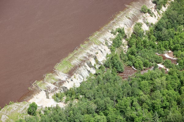
National faith in the levees-only approach came to an abrupt end in 1927. Water levels on parts of the Mississippi had already risen above flood stage by January, followed by snowmelt from the Missouri basin and heavy rainfall through the spring and summer. After decades of straight-jacketing by the Corps of Engineers, the Mississippi River broke through its levees from Memphis to the Gulf of Mexico, inundating millions of acres of floodplain and killing between 1,000 and perhaps 3,000 or more people.
The social and political fallout from the 1927 flood changed the U.S. (see "Rising Tide: The Great Mississippi Flood of 1927 and How it Changed America," by John M. Barry, Simon and Schuster, 1998), and forced the nation to do a 180-degree change in its approach to flood control. After categorically rejecting dams, the Corps had built 222 major reservoirs by 1965 (Morgan, 1971) and today operates about 700 nationwide. On the Mississippi River itself, the Corps replaced "levees only" with the Jadwin plan, which added dams on tributary rivers and bypass channels and other measures that have largely protected the Lower Mississippi Valley since 1927, including during extreme events such as in 2011 and now in 2019.
Fast-forward from 1927 to the present, and zoom out from the Lower Mississippi to the U.S. as a whole. Levees remain a primary tool for protecting communities and floodplain agriculture nationwide. Levee protection is supplemented by dams and bypasses as well as nonstructural measures, such as under the National Flood Insurance Program to limit and mitigate development on flood-prone land. The U.S. has also begun a few experiments with giving back "room for the rivers," whereby localized levee setbacks can increase flood safety for nearby population centers and provide broad environmental and recreational benefits. But … each time that skies cloud over and rivers rise, what floodplain residents and their political representatives clamor for is more and bigger levees.
For example, after widespread flooding in 2007, the Corps developed the Upper Mississippi River Comprehensive Plan, a sweeping proposal to spend about $6 billion to enlarge mostly agricultural levees along the Illinois River and the Upper Mississippi to the 500-year protection level (about 0.2 percent annual flood risk). Despite the price tag and an official benefits-to-cost ratio of 0.05—5 cents worth of benefits for every $1 invested—the Plan garnered the endorsements of the Corps' Mississippi Valley Commission and the governors of three states. Although Congress never appropriated funds for the Plan, advocates continue to lobby for it today.
The 2019 flood season began early, with record-breaking crests already in March on portions of the Missouri River and its tributaries. Since then, flood damages have covered many rivers and broad areas of the central and south-central U.S. Repair bills and total flood damages remain unknowable at present, but just on the Missouri River between Omaha and the confluence with the Mississippi River, 160 levee breaches will cost $1.9 billion to repair (according to Maj. Gen. Spellman testimony to Congress on July 10, 2019).
In addition, Congress is currently preparing a large investment in infrastructure in the form of a Water Resources Development Act (WRDA) planned for 2020. During recent hearings—in the midst of headlines dominated by flooding—Committee members quickly focused discussion on flood-related infrastructure and projects. As Maj. Gen. Michael Walsh, head of the Corps' Civil and Emergency Operations, said in an article in Progressive Farmer, "never waste a good emergency."
Levees are a seemingly instinctive response after flooding. Residents and politicians imagine impenetrable barriers that will solve flood risk "once and for all." FEMA currently draws U.S. flood maps exactly that way—with land behind levees accredited to at least the 100-year flood level removed from the floodplain, as if by a magic wand. In reality, levees always leave what is called a "residual risk" of flooding in the protected area, and no floodplain resident should sleep at night believing that their flood risk is completely gone.
In addition, by excluding water from one portion of the floodplain, levees export flood risk to neighboring land on the opposite bank, upstream, and, to an extent, downstream as well. Nonetheless, as elaborated by Charles Ellet almost 170 years ago, levees have a role in U.S. flood-risk management. The trick is to use them as part of a broad portfolio of protective strategies.
The 2019 flooding may be a crossroad, with our national response either being all-in investment in massive "levee only" repairs, or else we could take a few cautious steps to use this investment wisely and effectively. Currently, the federal statute governing post-flood levee repairs (Public Law 84-99) "provides by far the most generous cost-sharing formula of all the Corps' activities" (C. Berginnis, Association of State Flood Plain Managers, Congressional Testimony, on July 10, 2019). "Repeat offender" levees are repaired without tabulating the number of past repairs or cost to the taxpayer. And the Corps is reportedly considering loosening requirements so levee operators who have failed to comply with their obligations under PL 84-89 may nonetheless receive funded repairs.
In response to 2019 and future flooding, the Corps and Congress could learn lessons from FEMA. The National Flood Insurance Program has learned from painful experience that "repetitive loss" properties that have rebuilt in place time and again on U.S. floodplains require policy triggers to encourage mitigation alternatives. Recipients of repeated levee repair funding could similarly be required to consider alternatives such as levee setbacks (room for the river) or even property buyouts, which currently are not eligible for PL 84-99 funding. More systemically, both local jurisdictions and U.S. society as a whole need to recognize the "residual risk" of living behind levees and steer new development to alternative and flood-safe locations.
I once did an interview with a reporter who broke the ice by asking, "So Prof. Pinter, why do you hate levees?" I laughed and then explained how levees are valuable tools in a diverse toolkit used to manage flood risk. This is not new wisdom. The U.S. learned nearly a century ago that "levees only" is a failed path. Today in 2019, and after the floods that will inevitably come in the future, we need to resist the temptations of political expediency and apply the hard-won lessons of how best to manage our flood risk.