This article was published in Scientific American’s former blog network and reflects the views of the author, not necessarily those of Scientific American
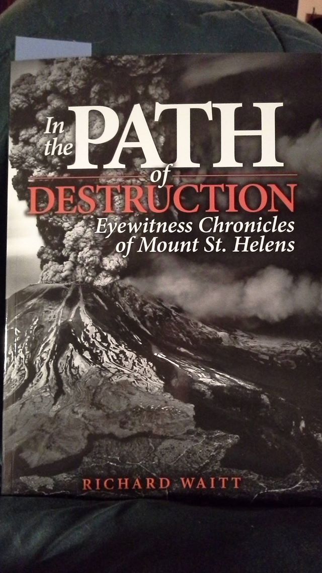
So, I'm really digging in to USGS Geologist Richard Waitt's new Mount St. Helens book:
This is like magic and I'm loving it so much! A geologist wrote about all the human drama, so my Mount St. Helens book can focus mostly on the geological drama, and I can point people to this book as a companion if they're like, "But what about teh hoominz?!" It's so incredibly nice to know I have a meticulously sourced, thoroughly researched, and well-written book penned by a USGS geologist who worked on Mount St. Helens during the 1980 eruptions. I'm only a few chapters in, and it's already delish. I've learned things about the people involved that I never knew before. The seismological drama is intense! And there's a nice interweaving of the geological and human aspects. I'll do a full and serious review for you once I've finished, but I've also been live-blogging my reactions to it on Facebook. For some scenes and interactions, I'm using the internet's favorite language: LOLspeak. Look, it was like three in the morning and I was in an odd headspace, okay?
On supporting science journalism
If you're enjoying this article, consider supporting our award-winning journalism by subscribing. By purchasing a subscription you are helping to ensure the future of impactful stories about the discoveries and ideas shaping our world today.
Since the hashtag doesn't arrange the posts in chronological order, I figured I'd repost them here for those who wish to follow along. And for this first post, I'll add in the first few chapters, as I didn't start actually noting my reactions until Chapter Three.
The Stick
We may shrink in grief, but let us begin. What Richard is saying, people, is that when we get to the big ba-boom, you'd better have a box or two of tissues with you.
Before
Logger to USGS Geologists Rick Hoblitt and Jim Vallance: When's the big eruption?
Hoblitt: LOL dunno mebbe next year?
What's eerie is that he was only a couple years off...
**
Labor Day weekend mudflow down Dry Gulch: Wheeee!!!!
Campers, geologists, and loggers trapped when it overflows the road: D'oh!
Yes, folks, volcanoes don't have to erupt to be dangerous.
Chapter 1: Seismograph (March 19-24)
Students climbing to the summit stop 2,000 feet shy. "We're outta shape!" they sigh, and turn back. You know, kids, in a few months, you'll have less than 700 feet to go!
**
Earthquake happens. Students and Forest Service Ranger Sharon Burchard zip over to Timberline and look up the mountain to see that an avalanche has happened where they would've been right then if they'd kept climbing.
Students: Woah... if we weren't out of shape, we'd be all dead!
Ranger Burchard: Toldja it was a bad day to climb!
**
Woot! David Johnston was in Corvallis, Oregon when the earthquakes started, and in Seattle as they intensified! He helped the seismologists out. Richard Waitt calls him Captain Midnight for taking the night shift. What an awesome guy!
**
Mag. 4.4 earthquake hits after a bunch of smaller ones.
University of Washington Seismologist Elliot Endo: This ain't no aftershock sequence! This is a volcanic swarm!
**
The description of the earthquake swarm that happened 1 mile beneath Mount St. Helens in late March 1980 reminds me of contractions: becoming more numerous, stronger and closer together before the big event (in this case, a small initial eruption). Alas, Richard's gonna make you wait for the bouncing baby erupting volcano.
Chapter 2: Stage
Richard Waitt sets the stage by telling us why Mount St. Helens is where it is, why it erupts explosively, and then lists off a bunch of volcanoes that killed tens of thousands of people in the past. Moral: don't whine about paying for volcano monitoring, people! Other moral: even with monitoring, volcanoes be dangerous.
**
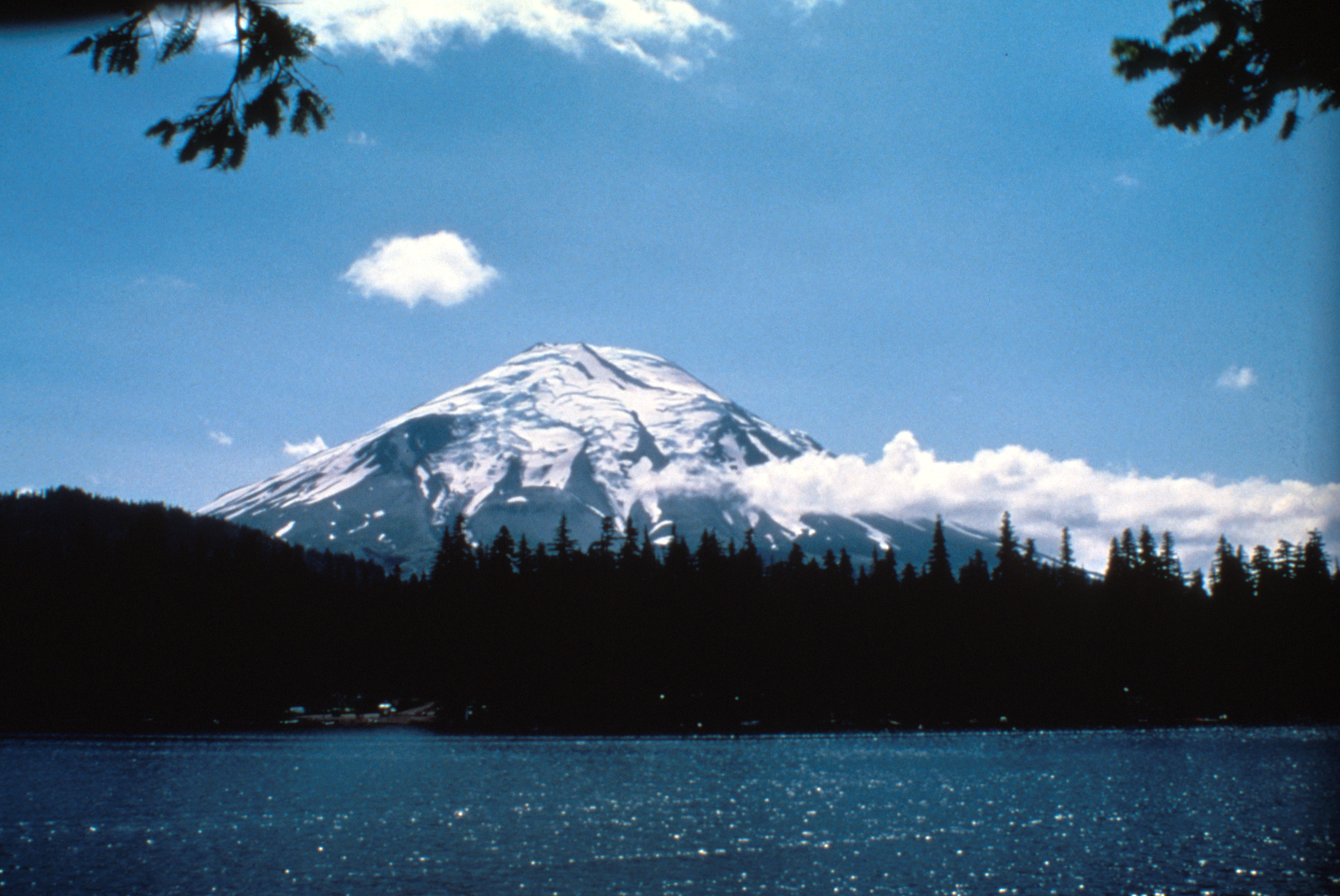
Description of the historical eruptions and Native American legends and memories of the mountain. Excerpts from explorers' journals. Clark describes it as a "Sugar lofe." True story: I had to look up what a sugarloaf is. Turns out the history of sugar is fascinating. And, yep, Mount St. Helens really did look like a sugar loaf.
**
USGS Geologists Donal Mullineaux and Dwight "Rocky" Crandell (after a study of MSH's eruption history): Yep, she's sure gonna blow, maybe even like Vesuvius. Could happen by the end of this century.
Various Reporters: Bwhatevar! Silly guvmint science people just want attention!
Mount St. Helens: ...Tick-tock, you bastards...
**
Turns out Governor Dixy Lee Ray was a pretty keen scientist. She was elected as a Democrat, but was a Republican at heart. I had no idea.
**
We were supremely fortunate on the timing of Mount St. Helens’s eruption. USGS geologists Crandell and Mullineaux had just finished an in-depth study of its past eruptions and issued a booklet on its hazards a couple of years before. They were still around when it woke up and were able to be on the ground advising before the first eruption. We had instruments that were able to monitor the changes and give us hints as to what was about to happen. There was no way to predict exactly when or if it would blow. But because we had those things, we got to study it fromstart to finish, learn a lot, and save countless lives in the process. That's actually pretty amazing.
Chapter 3: Geyser
I've reached a point in Waitt's book where he's talking about Harry Truman, the crusty old dude who refused to evacuate and got buried on the shores of Spirit Lake. He'd lost his wife, he was old, and he was willing to die with his mountain. I have no quibble with his decision, but I wish he'd sent his cats to safety. All those poor kitties...
**
Word o' advice: when officials tell you the road's closed cuz the volcano might asplode, don't argue.
**
Hahahaha! There was a dude named Stan Lee living in Kid Valley, just down Highway 504 from Mount St. Helens. He thought the earthquakes were a USFS plot to delay development. I'm totally picturing comic book legend Stan Lee playing this Stan Lee in a movie about the eruption, lol.
**
Radio reporter flying over Mount St. Helens’s summit just after its first eruption on March 27th, 1980: "OMG! It's erupting! Put me on the air!!"
DJ spinning the Beach Boys: LOL NOPE.
Priorities, people. DJ haz 'em. Shame about his lack of instinct for news...
**
Sheriff and WA Dept. of Emergency Services: "Stop scaring everyone! Don't say it's erupting! It's not erupting! It's just exploding a little bit!"
Radio Reporter: "LOL NOPE."
**
USGS on the morning of March 27th: "Earthquakes don't necessarily mean that the volcano's about to erupt."
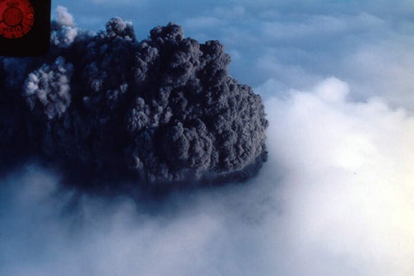
Mount St. Helens at 12:36pm: BA-BOOM
USGS that afternoon: "Of course, in this case, earthquakes totally did mean the volcano was about to erupt."
**
KING5 News: "Woot! Let's go see the eruption!"
USGS volcanologist David Johnston: "O-kay."
Helicopter lands at Timberline. Earthquakes bounce the rotor blades.
USGS volcanologist David Johnston: "So, yeah, the volcano in Alaska I studied had a little boom, lotsa earthquakes, real big boom, then the next morning HUGE BA-BOOM. Incidentally, if this volcano erupts right now, we're all gonna die."
KING5 News: "RUN AWAY!!!"
**
Reporter: "Melting snow will snuff out the volcano, right?
USGS geologist Donal Mullineaux: "LOL NOPE."
**
(Not comic book) Stan Lee: "That mountain's not erupting!"
Mount St. Helens: *continues to erupt*
Stan Lee, everybody: the original Tea Party Republican.

**
Using Spirit Lake as a spirit level is pretty clever. They did it by nailing yardsticks to docks and stumps and such around the lake: if one side's sticks dip while the others rise, they'll know there's a big magma body intruding. Sweet!
**
USGS's Susan Kieffer and her husband camp out on Mount St. Helens. She films eruption after eruption during the following day. She thinks the rhythmic eruptions might mean that water in a volcanic chimney is being repeatedly heated by magma. This is where the chapter title comes from: the geyer-like nature of those eruptions.
**
ZOMG. Some dude hitchhiked over and then climbed to the summit of Mount St. Helens on April 2, 1980. People, please: if you're not employed to do so, please don't hike volcanoes that might explode catastrophically at any second.
Fifteen feet of new rock on top of the ice at the craters' edges. Wow.
**
USGS Geologist Rocky Crandell: We've got the roads closed because it's dangerous. Look, see this hazard map? Lots of hazards.
Loggers: We eat danger for breakfast!
Timber Attorney: Nyah nyah I don't believe you! Nobody has authority to close these roads! Pbbt!
Crandell: *headdesk*
**
Every so often, I run into a name and recognize it as a person who will soon be dead. It's jarring every time.
**
End of the chapter is basically describing the hassle and expense of trying to manage an active volcano that happens to be a popular recreation spot and economic engine for loggers, resort owners, and various merchants. Add to that a governor who loves to play politics more than surround herself with the best possible people for the job. Agencies are running out of money. Manpower's stretched thin. Tourists are using logging roads to get around roadblocks. And no one knows when or if the mountain will catastrophically erupt. Timberline is swelling and contracting every day, as if the volcano breathes.
We need to do far better at handling these events.
***
That's all for this edition. Join me back here soon for more, or if you absolutely can't wait for moar, follow me on Facebook. If you want to purchase your very own copy of In the Path of Destruction, buying through this link will help support my blogging career. And if you want to focus in on the geological drama, you can start with my Prelude to a Catastrophe series. Enjoy!