This article was published in Scientific American’s former blog network and reflects the views of the author, not necessarily those of Scientific American
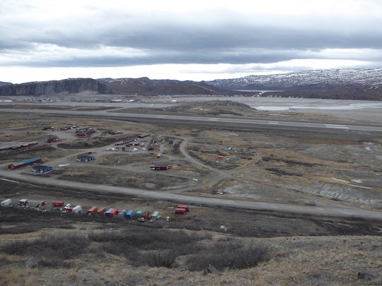
Everyone warned me that Greenland would be cold. They said I should buy snow boots, snow pants, heavy-duty gloves. I packed layers upon layers, topped off with an extra-warm scarf, knowing that in early April, the temperatures could easily be below freezing, and on the ice sheet it could be much worse. So when my Air Greenland plane landed on the airstrip at Kangerlussuaq, Greenland this past April, I put on my down coat, scarf, gloves. I stepped out into the fresh air.

And I was hot.
On supporting science journalism
If you're enjoying this article, consider supporting our award-winning journalism by subscribing. By purchasing a subscription you are helping to ensure the future of impactful stories about the discoveries and ideas shaping our world today.
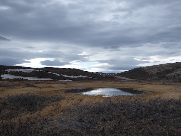
The day I arrived, the temperatures topped off at around 60° Fahrenheit, even warmer than my home back in Texas at that time. Before long, I had removed all my winter gear and was hiking the dusty hills of the Arctic landscape in short sleeves.
Given that I was in Greenland for the week as part of my studies in climate change, and that I had been closely following the satellite monitoring and models of Greenlandic temperature, I shouldn’t have been surprised. Every month of 2016 so far had broken temperature records But being in a place with one of the only two ice sheets in the world and being warmer than I would be in Texas, or California, or Copenhagen was overwhelming. Of course, weather isn’t climate, I thought. The sixty-degree temperature was likely a fluke, a product of our planet's unpredictable weather system.
The next day, I hiked up to an outlet of the Greenland Ice Sheet called Russell Glacier with my group. The glacier stood at 100 feet tall, but I didn’t think too much of this beforehand. I had learned in classes that the ice at the summit was three kilometers thick. As I walked up to the glacier, what seemed like a blip on the drive over grew taller until I stood before the wall of ice that stretched towards the sky, a brilliant blue because light travels a greater distance in glacier ice than it does in typical ice. It formed intricate shapes created by the natural deformation of the ice. What looked like a solid structure was really more of a viscous fluid, flowing away from the summit, constantly in motion. Our instructor told us that if we sat in front of the glacier and listened closely, we could hear the creaking of ice as it slowly moved, stretching farther towards the town of Kangerlussuaq like the flow of pizza dough. But as I sat in front of the edge of an expanse of ice over 600,000 mi2, I didn’t hear groaning of ice. I heard the rushing of water.
.JPG?w=600)
Because the glacier edge sat in a growing river of meltwater, all coming from different areas of the ice sheet and flowing like rapids downhill, towards the town. A week prior, all of the glacier had been completely frozen.
It’s not unusual to see meltwater from the ice sheet or from Russell Glacier and for it to flow towards the town. The name ‘Kangerlussuaq’ in Greenlandic means “Rather Large Fjord”; the town sits in a valley at the edge of the North Atlantic. The Watson River takes up much of the meltwater from Russell Glacier and runs through the town before emptying into the fjord. But increased melt from the ice sheet poses a serious problem to the community, and it was all made clear in 2012.
In 2012, Greenland experienced an unprecedented melt event. Around 97 percent of the ice sheet’s surface was melting to some degree, which utterly overwhelmed this river. The huge amounts of flooding wouldn’t normally be such a major issue, except for a bridge that runs over this Watson River. This bridge contains the pipe that supplies water to the town and important cables that run the power grid and radar for the town and the airport. So when the flooding of 2012 reached the bridge, it destroyed it, creating a crisis for the town and threatening to shut down the entire country—a country that depends on outside help for produce, diesel, and other key supplies. While I am used to hearing “climate change could affect us by 2025 or 2050,” it’s a problem for the communities of Greenland now.

It’s not just the melt either. While we hiked away from Russell Glacier, our guide stopped and stared at something. When he turned around, he was holding a tiny mosquito in his palm—not something I would have thought twice about. But he took pictures of it, showed my instructor, and they started discussing it at length. It was early April, and mosquitoes don’t come out in Greenland until June.
I headed out two days later to Point 660, the area where it’s easiest to walk up onto the ice sheet itself. The drive out to Point 660 itself was beautiful—a drive through mountains peppered with brilliant white Arctic hares and grazing reindeer, all the while an expanse of white and blue easily seen up ahead. We parked a few hundred yards away and walked over what I would have just considered hills of loose dirt that ran around the edge of the ice sheet. However, those hills of loose dirt are geologically important; they’re called moraines, and they are created by the advancement of a glacier.
As a glacier grows and advances on land, it pushes up dirt and loose sediment into hills; then, when it retreats through melting, it leaves those hills as a marker of where the glacier used to be. My instructor first went to Greenland in 1999, when the ice sheet began right at the base of these moraines. Now, as we walked along them towards the expanse of ice, there was a gap of over 100 meters, which is a lot more than can be explained simply by seasonal fluctuation.

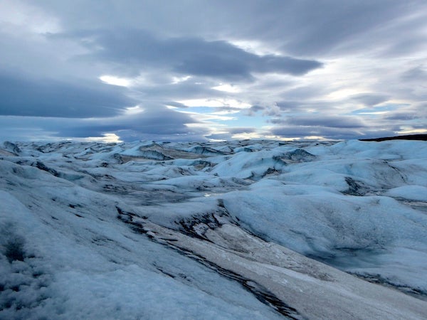
Being on the ice itself was the most calming moment of the trip, especially once you get the hang of carefully walking on small hills of slick ice. All you can see stretching out in front of you is blue and white, like a silent sea that’s been frozen in time. We walked over ice 30,000 years old, with bubbles of air trapped inside just like the ones scientists use to reconstruct ancient atmospheres. There were no smells and, other than the sound of flowing melt streams, no sounds. It was only then that it hit me—the Greenland ice sheet, and the country of Greenland, is an incredibly unique place. The bottom of the ice sheet, where the ice hits the bedrock underneath, contains real remnants of thousands of years ago, before the Ice Age, before humans even existed as a species. And piled on top of it is ice that contains information about thousands of years of climate, most of which tells human history. The geography of the landscape tells stories of a time where Greenland was covered completely in ice, and a time where the ice sheet was far, far smaller than it is today.
The Arctic provides a unique environment for communities to thrive in conditions not seen many other places on the planet. Even the coffee, which I got the pleasure of trying, gives an outside observer the sense of what Greenlandic natives grow up in—the drink comes with a dollop of whipped cream on top, which symbolizes the ice sheet, and a drizzle of Grand Marnier lit on fire, symbolizing the Northern Lights that are especially bright in Kangerlussuaq. I can’t imagine living thirty minutes away from such a huge expanse of ice. It’s a special place on Earth, and unfortunately a lot of what makes it special is changing.
It was only later I found out that Tuesday, April 12, the day that I witnessed the meltwater around Russell Glacier, broke records. It marked the earliest start to the Greenland melt season on record. The season officially begins when 10 percent of the surface ice is melting. On April 12th, 12 percent of the surface was melting (based on satellite observations, human observations, and climate models). Before this year, the record for earliest start to the melt season was on May 5th.
Not only that: during the week that I was there, temperatures in Kangerlussuaq reached 64˚F. And all over the country, even at the highest point on ice sheet, temperature records were broken by large margins. In fact, the thermometer that week reached levels a full 20-40˚F higher than the average for that time of year in Kangerlussuaq. While what I experienced that week was weather—short term, local fluctuations in temperature and conditions – it was clearly part of a broader climactic trend.
But I didn’t really need to hear those numbers to know something big was happening in Greenland. I could tell by the way the locals were talking in the airport, wondering what was up with the crazy weather. I could tell by the increased vigor of the water flowing down Watson River. I could tell by the meltwater streams directly on the ice sheet and the changing biology of the area. Climate change isn’t obvious all over the world, but it is strikingly obvious in Greenland, and it was very clear to me how important it is to preserve such an important place on Earth. I hope to be back many years in the future, to see Russell Glacier standing at 100 feet and walking back on the frozen sea of ice that quite literally tells our own history.